| Sometimes scientists work on holidays, and collectors of the millions of plant specimens found in herbaria are no exception. Opportunities to document where and when plants occur are numerous; even a Christmas stroll can turn into an expedition. For example, the robust weed shown on the right, an introduced species to California called "buckhorn plantain", was collected on December 25th, 1994. We don't know the whole story about this specimen. Why was Fred Hrusa, then a Ph.D. student at UC Davis, traveling in Monterey county, a good 170 miles from Davis? Perhaps he was visiting family, a friend, or just the marvelous beauty of the California coast. What we do know, thanks to his careful record-keeping, is when and where this plant species was found, what it looked like, and whether it was reproductive. | 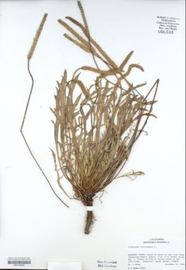 |
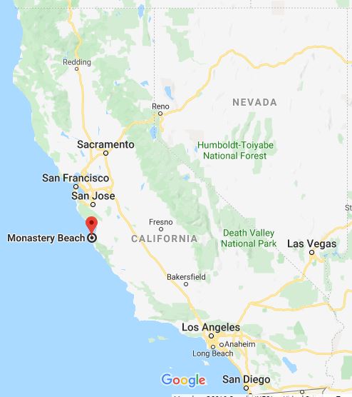
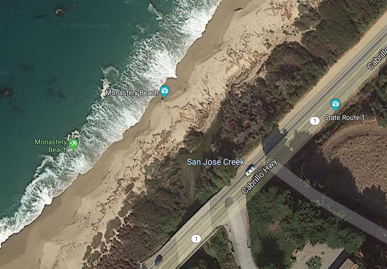
Although he didn't have a GPS handy, Hrusa's description leads us to a fairly specific place on the landscape. The text of the label says "Beach at mouth of San Jose Creek (Monastery Beach) approx. 2 mi. S of Carmel along Hwy. 1. Colony on flat at actual mouth of San Jose Creek." From this information, we can determine the approximate latitude and longitude (with an appropriate approximation of the error of that estimation) of the plant's location. The process of determining geographic coordinates of a specimen from the provided text is called georeferencing.
 |  |
Georeferencing is an important task. Without georeferenced coordinates, it is difficult to visualize plant collections on a map or create spatial models. The CAP TCN aims to georeference hundreds of thousands of herbarium specimen records using a variety of tools in our data portal (cch2.org). Interested in learning more? Visit our georeferencing page for helpful resources.
Thanks to collectors like Fred Hrusa, we have a better idea of plant distributions over time and space, even on Christmas day.
Glossary
- error - uncertainty about the provided coordinates resulting from georeferencing; this is often indicated as an error radius or an error polygon
- georeferencing - the process of interpreting the textual information about a location and assigning latitude and longitude coordinates, as well as an indication of uncertainty, to that location